UW Automatic Weather Stations - 2019
| Regions:Years: |
Queen Maud Land Stations (2019): |
|
Jan-2 AWSOwner:Site Code: JA2 Initial Start Date: 2017-12-10 Installed: 2017-12-10 Latitude: -70.537 S Longitude: 24.183 E Elevation: 266 meters AWS Model: AWSCR1000 Notes: This AWS was installed by Jan Lenaerts and his team on December 10th, 2017. These AWS are different than the normal style AWS because they have a titlmeter, CNR4, and Taylor wind sensor system. The elevation was calculated using the World Geodetic System 1984 (WGS84) ellipsoidal height obtained from the Polar Geospatial Center (PGC) Reference Elevation Model of Antarctica (REMA) and calculating the orthometric height above the Earth Graviational Modem 1996 (EGM96) geoid using UNAVCOs geoid height calculator (https://www.unavco.org/software/geodetic-utilities/geoid-height-calculator/geoid-height-calculator.html). | 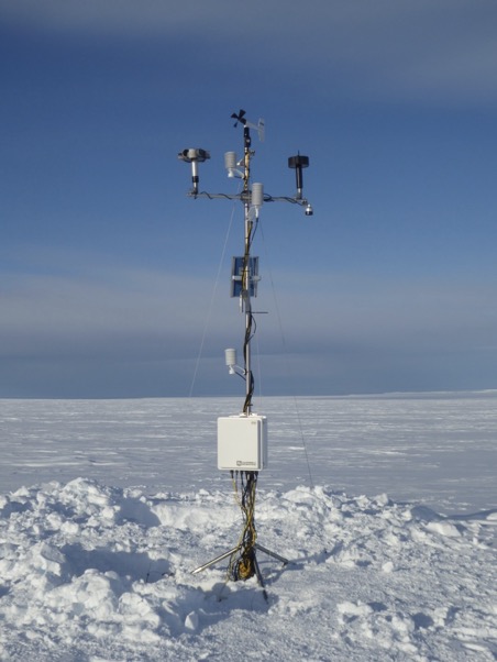 1 Photo | |